
OUR SERVICES

IGRIS Scanning Solution
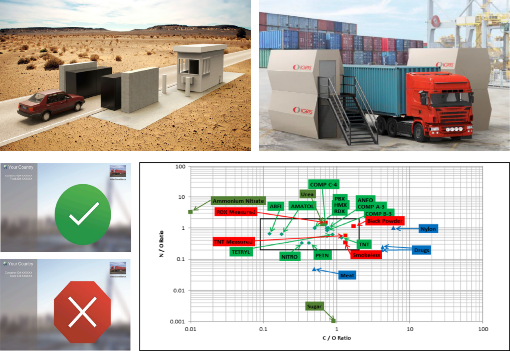
Inelastic Gamma Ray Imaging Scanner (IGRIS) is a neutron-based technology that offers a three-dimensional (3D) computerized advanced scanning and detection system that will analyse the composition of various substances and materials including organic and contraband constituents transported in:
• Maritime Cargo Containers
• Air Freight
• Vehicles, and
• Intermodal Containers

GRIS was developed by four dedicated scientists with PhDs in Nuclear Physics. They have spent more than 35 years focused on one primary goal: neutron scanning for the detection of contraband, explosives, and items of interest to National Security, Customs, and other authorities. IGRIS has been developing neutron scanning technology using the associated particle time of flight techniques since the 1980s. IGRIS is the world’s most advanced scanning and detection technology.
The IGRIS technology will detect all substances of interest that are programmed in the system in any form such as;
• Explosives; both liquids and/or solids
• Drugs and contraband
• Chemicals
• Black powder (ammunition, explosives)
• Nuclear and radioactive material
• All organic substances such as tobacco, alcohol, soybean meal, corn, meat, coffee, sugar (and other food products), wood, ivory, minerals, silver, gold, hard currencies, etc.
With a 99.9% accuracy, IGRIS is the most advanced scanning system in the world that scans a 20 ft container in seconds. Offering a 3D scanning and detection system, it analyzes the composition of materials transported through all shipment modes.
How Does It Work?
• Neutron Radiation - IGRIS uses neutron-based technology to analyze the atomic structure of materials.
• 3D Scanning - The scanning system captures high-quality images of container contents regardless of location or position.
• Data Analysis - IGRIS technology uses AI analysis to identify and flag any contraband.
Cargo Inspections & Border Protections
• Detected Items - IGRIS technology provides detailed analysis to customs and border agents to flag any contraband or suspicious materials detected.
• Efficiency - Reduces inspection time and streamlines the shipping process.
• Cost Savings - Reduces costs associated with missed inspections, seizure of goods, and security risks.
• Customs and Border Protection Benefits - The technology enables border agents to identify illegal shipments quickly and more efficiently, thereby protecting their country's borders.
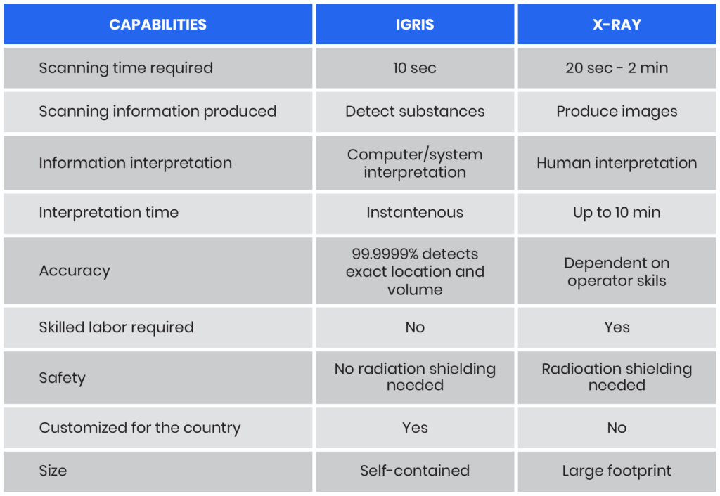
IGRIS Versus X-Ray Scanners
Applications of IGRIS Technology
1. Security Screening
• Screening of bags and other baggage items for security risks, explosives, and weapon detection.
2. Maritime Security
• Used in container ports for security and compliance with international standards.
3. Aviation Security
• Used in airports for cargo freight inspection and security.
Costs of Implementation
IGRIS provides the world's most advanced form of scanning and detection system. It provides significant benefits in terms of security, efficiency and increased revenues. More importantly, the costs to a client is minimum. IGRIS can be deployed using a Government Operates Company Own and Maintains (GOCOM) or Publics-Private Partnership (PPP) model.

ICT Solutions Provider
The business world thrives on the flow of information – which is why a reliable and secure ICT infrastructure is vital for any business to success. Customised technology financing, leasing, rental, subscription, utility charge, transaction charge, manage services and asset disposal solutions to address each IT lifecycle stage.
Technology Financing
Technology Financing solutions refers to a combination of ICT solutions and financing solutions to provide customers with access to ICT solutions on a subscription basis, thereby spreading the cost of the customer over time, whilst providing customers with an ease of mind as such ICT solutions are covered with maintenance services.
Trading of ICT Solutions
We trade new ICT hardware and software and refurbished ICT hardware, employing both direct sales channels and through our proprietary e-commerce platform. These sales are transaction-based in nature and typically do not include ICT maintenance and technical support services.
Provisions of ICT Services
We charge maintenance and service fees for providing ICT maintenance and technical support services. These fees encompass a spectrum of services, ranging from corrective and preventive maintenance to comprehensive technical support, ensuring the sustained functionality of ICT solutions provided to our customers.
Provision of Cloud Solution and Services
We offer cloud solutions to our customers, including infrastructure as a service (IaaS), platform as a service (PaaS), and software as a service (SaaS) through a subscription fee model. This service is complemented by ICT consultancy services specifically tailored for cloud solutions. The consultancy services involve proposing suitable cloud-based infrastructure and solutions and guiding customers through migrating their software applications and data from on-premises ICT infrastructure to cloud-based alternatives.
Web Application and API Protection Solutions
The Cyber Security Application Delivery and Security Platform (ADSP) converges essential defenses—WAF, API security, bot management, DDoS mitigation, and more—into an integrated Web App and API Protection (WAAP) solution. As AI, hybrid multicloud architectures, and API sprawl continue to expand the attack surface, point products are creating gaps and management overhead. Integrated WAAP reduces sprawl and complexity, improve consistency, and protect critical digital experiences from evolving runtime attacks.

Cyber Intelligence
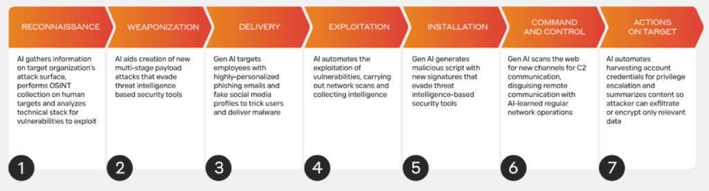
Artificial intelligence (AI) is enabling cyber-criminals to generate highly personalised and unique attacks at scale. Meanwhile, cyber defense is playing catch up, relying on historical attack data to spot threats when they reoccur. But when novel attacks are the new normal, this approach is no longer enough. Our product suite is underpinned by our unique Self-Learning Cyber AI. Rather than learn from previously encountered attacks, our unique Self-Learning AI takes a different approach. It understands your organization, learning from every user and device, and the connections between them. This means it can reveal subtle deviations that point to a cyber-threat – even one augmented by AI, using tools and techniques that have never been seen before. Our level of expertise covers;
Prevent
Empowers security teams to reduce cyber risk by prioritizing vulnerabilities and hardening defenses proactively.
Detect
Delivers instant visibility of known and novel threats, powered by a continuously evolving understanding of your business.
Respond
Acts autonomously to interrupt cyber-attacks with precise and targeted actions, without disrupting regular business operations.
Recovery
Automates incident recovery processes, allowing organizations to return systems to a trusted operational state in the event of a cyber-attack.
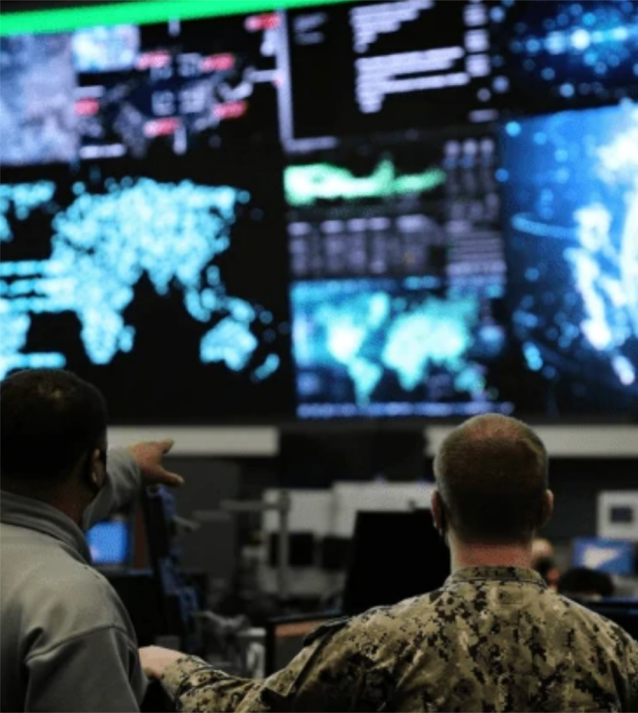
Open-Source Intelligence
Al technology automatically identifies sensitive Open-Source Intelligence (OSINT) that needs to be alerted and notifies users at the minute level. Generating real-time OSINT. The best way to manage a negative public relations incident or negative viral social media activity is to be prepared by planning ahead. We provide solution responsible for the collection, analysis, and exploitation of information in support of law enforcement, national security, military, and foreign policy objectives. Key challenge for OSINT implementation;
Business Challenges
• Demand for economic intelligence
• Transnational organized crime
• The global war on terrorism
Technical Challenges
• The expansion of social media
• The expansion of cybersecurity issues
• The use of cryptocurrancies and dark web
System Challenges
• Need a more efficient collection and analysis
• Need innovative ways to handle the explosion in the volume, velocity, and variety of data.
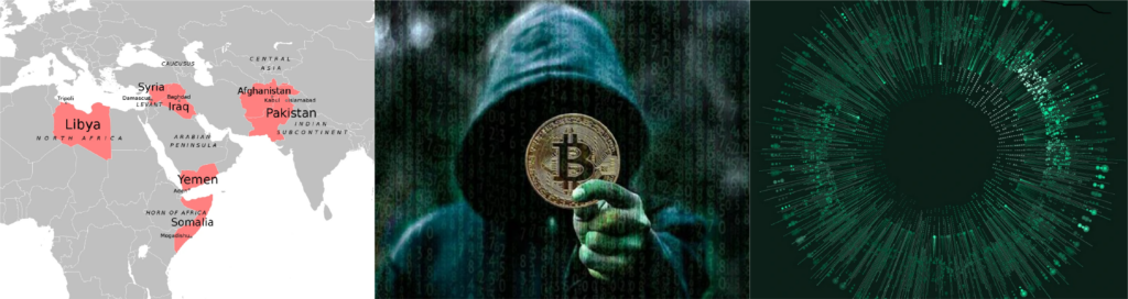
Our OSINT solution covers for Intelligence Agency, Counterterrorism, Homeland Security, Criminal Investigation, Lawful Interception and Digital Forensics.
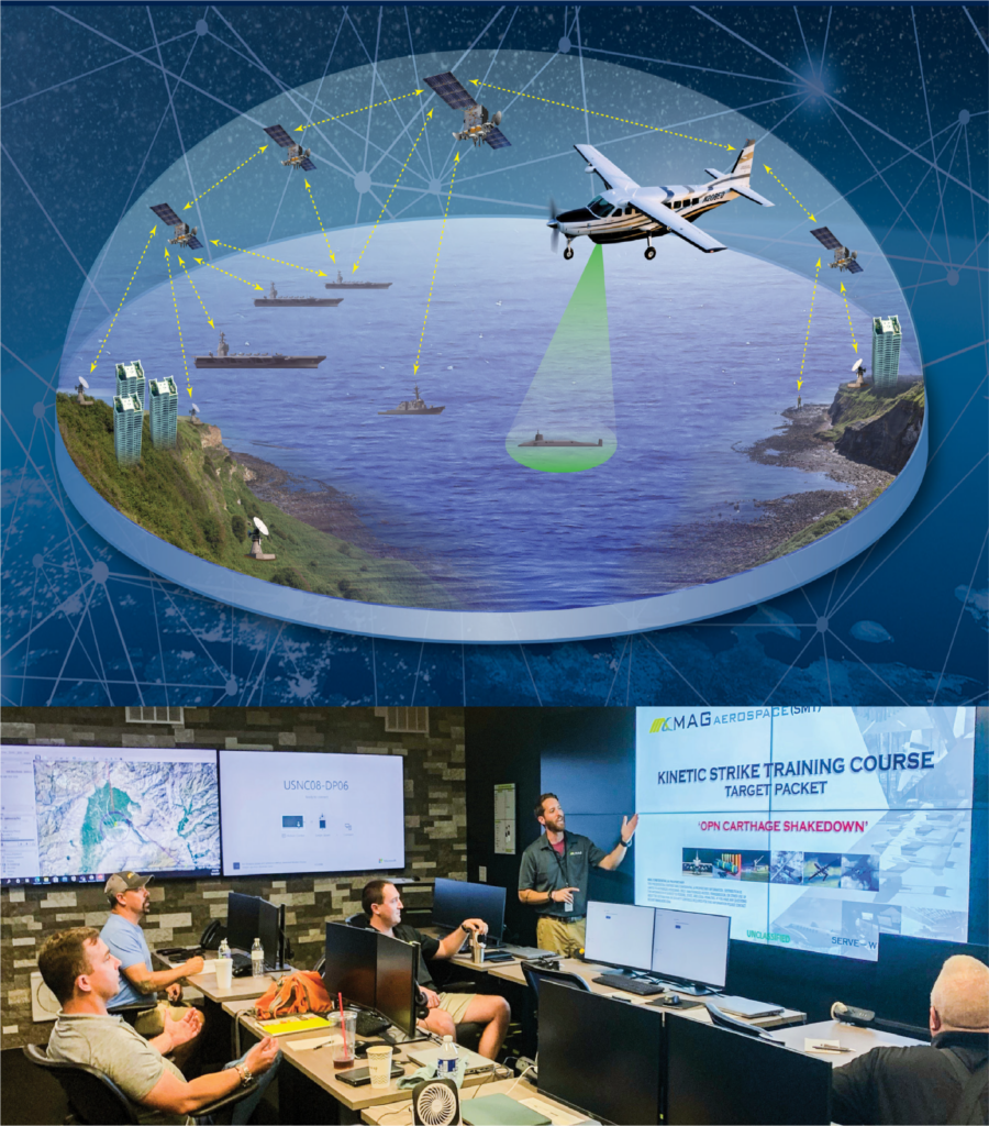
Signal Intelligence
Signal Intelligence (SIGINT) provide solution for interception and collection of information from various electronic signals. It is an essential tool used by many organizations, most notably the military, to better understand their opponents’ activities and intentions. The collection of signals and communication-related information is used to gain insight into the workings of an adversary or target. SIGINT uses various methods, such as;
• Listening to radio waves
• Monitoring satellite communications
• Decoding encrypted messages
• Intercepting telephone conversations
• Analyzing open-source data
To obtain this kind of information, intelligence agencies may employ electronic means, including satellites, aircraft with special equipment, bugging devices, and interception of fiber optic cables. All data collected through SIGINT can be used for counterintelligence purposes by determining the capabilities and intentions of a foreign power or other adversaries.
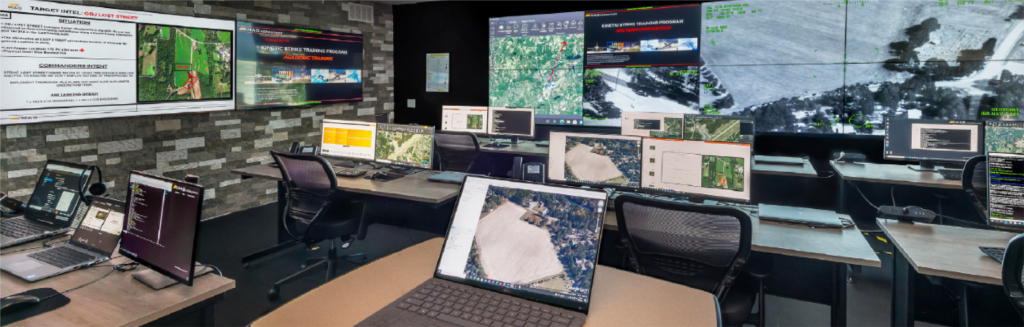
Analysis view
• Explorative investigations using drill-down filtering
• Data enrichment (languages, geo IP, user-actions)
• Pattern visualization
• Relationship- & network diagrams
Investigation view
• Sequential workflow based on cases and taps
• Customizable event-list
• Supports different workflows
Multidimensional Drill-down
• Combination of filters from numerous dimensions
• Interactive timeline
• Text filter
• Navigators
Satellite’s Intelligence
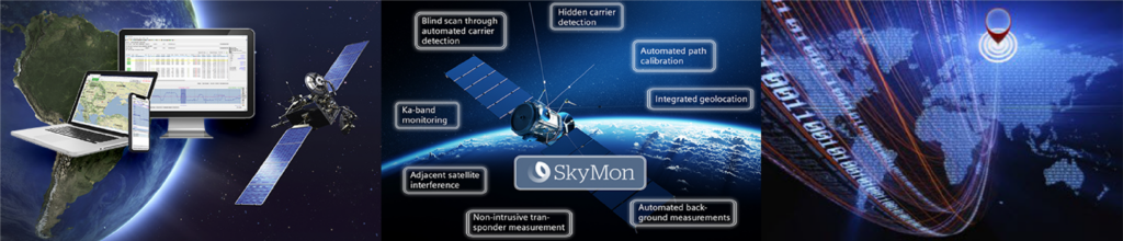
As technology becomes more complex, managing security environments is becoming increasingly challenging, especially for government authorities involved in the surveillance of communications traffic across various satellite networks. Our SkyMon is the satellite carrier monitoring and interference localization solution that lets you identify interference and manage carriers in one comprehensive system while minimizing your investments. Its modular architecture can be customized to integrate with your existing infrastructure.
Our solution covers 3 networks; Thuraya, Isat, Iridium with SDR-based solution.
Satellites monitored
Thuraya 7 spot beams, 1 satellite at a time
Inmarsat 7 spot beams, 1 satellite at a time
Iridium 10 satellites with each with 5+ spots.
(Depending on antenna configurations)
Concurrent Calls
100 Simplex calls and 50 Simultaneous Duplex calls in total
Intercepted Data
IMEI, IMSI, TMSI*, GPS location, Audio, SMS, SBD, FAX, Telephone Numbers
This technology are the future options for GlobalStar and Snapdragon with NATO Approved Devices.
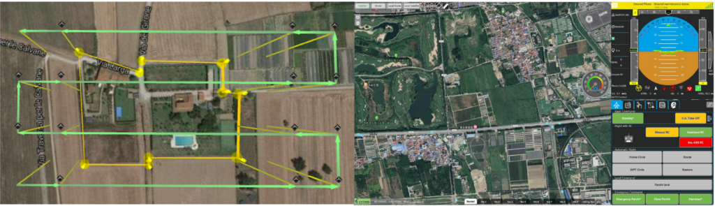
Ground Control Station
• Integrated UAV Control
• Flight Path Planning
• Flight Boundaries
• Flight Parameters
• Scanning Area
• Data Storage
Geospatial Intelligence
We provide a complete spectrum of geospatial and technology driven solutions customizable to both public and private sector clients. Our consultancy services include geospatial operation, geospatial information and management, system development and marine services – which are essential to planning the what, when, and why at where.
We can offer customized solutions in the following:
• Geospatial Operation
• Geospatial Information and Management
• System Development
• Marine Services
Precision Location Data
Geospatial Intelligence (GEOINT) will allow applications to provide better services by analyzing the precise locations of billions of mobile phone users in every part of the planet. Precision location data also applies to vehicles, ATM transaction locations and online activities.
Remotely Sensed Information
GEOINT / GIS analysis of high-resolution imaging from space will become more accessible for any enterprise with the advent of reusable, commercial rockets and smaller, less expensive satellites. Unmanned aerial vehicles will also provide imaging for everyone from agriculturalists to disaster response personnel.
Processing Power
The potential of GEOINT-related data will only grow with the increase of high-power computing. This will facilitate large-scale crowdsourcing of imagery. For example, crowdsourced “crisis mapping” of humanitarian relief efforts for natural or manmade disasters.
Data Analytics
GEOINT will benefit from and contribute to advances in data and predictive analytics in fields like health care, telecommunications, utilities, banking and insurance.
Virtual and Augmented Reality
GEOINT data is essential to accurately model real locations in gaming, virtual reality and augmented reality environments.
The Internet of Things
GEOINT will facilitate greater understanding of the live-streaming of data from every product people use.

Border Monitoring
A persistent data stream and a constant overview of the situation and operations at the borders will detect and react to activities quickly and effectively, and even predict future events to ensure national security. Border enforcement agency need to detect any unexpected actions near the borders and in the wider area, including the concentration of vehicles and equipment clock even in inaccessible areas.
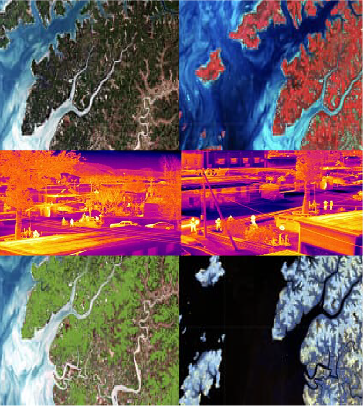
Through our experience in Satellite, Drone, and Geospatial Technologies we are able to provide solution for detailed, high-revisit, and comprehensive monitoring that can cover vast areas along the borders daily or even sub-daily. One of our unique capabilities is to collect high-resolution images even at night, through clouds, rain, fog, and smoke.
Daily Coherent Ground Track Repeat imagery helps you identify the smallest changes happening between image acquisitions. You can see millimeter-level ground changes not visible to the human eye, caused by vehicle traffic or other activity on a gravel road, grass, or in a desert. Obtaining this level of information every 24 hours. Our solution focus on site activity monitoring, port monitoring, oil spills, deforestation monitoring and maritime domain awareness.
Unequaled Visibility
Get high-resolution visibility into any location, day, or night, through clouds and darkness with the world’s most advanced SAR satellite imaging.
Forensic-level Detection
Image your location of interest daily and detect changes at an accuracy level.
Actionable Intelligence
Stay alert with accurate data on changes at or beyond your borders. React to any activities that affect national security and infrastructure safety.
Flexible Monitoring
Monitor your borders according to your needs. Get a single image of an area of up to 50,000 km² or zoom in to areas down to less than a meter.
Timely Delivery
Get data delivery 8 hours from image acquisition as a standard. For urgent requests, data delivery is possible in as little as a few hours.
Trusted Partner
Long track record of serving the world’s most demanding national security needs. Reliable data from a reliable partner.